Geolocate

Lavale topographic map

Click on the map to display elevation.

About this map
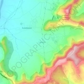
Name: Lavale topographic map, elevation, terrain.

Location: Lavale, Mulshi Subdistrict, Pune District, Maharashtra, 412115, India (18.50302 73.70240 18.54302 73.74240)

Average elevation: 2,119 ft

Minimum elevation: 1,818 ft

Maximum elevation: 2,671 ft

Other topographic maps

Click on a map to view its topography, its elevation and its terrain.

Temghar dam

India > Maharashtra > Mulshi Subdistrict

Average elevation: 2,444 ft

Mulshi Dam

India > Maharashtra > Mulshi Subdistrict > Sambhave

Average elevation: 1,995 ft

Shirgaon

India > Maharashtra > Mulshi Subdistrict

Average elevation: 2,257 ft

Gear up for your next adventure:

🧤Tactile Hiking Gloves - Keep hands warm while operating GPS and smartphone screens
☕Camping Coffee Makers - Enjoy premium coffee at the summit or campsite
🎒Waterproof Dry Bags - Keep your electronics and maps dry inside your pack
🌎3D Topographic Globes - Raised relief globes for a tactile understanding of geography
🔋Solar Power Banks - Keep your GPS and phone charged in remote wilderness areas

As an Amazon Associate, this site earns from qualifying purchases at no extra cost to you.