Geolocate

Wrawby topographic map

Click on the map to display elevation.

About this map

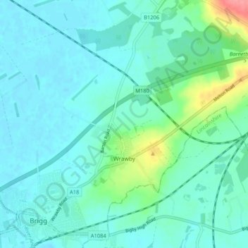
Name: Wrawby topographic map, elevation, terrain.

Location: Wrawby, North Lincolnshire, England, United Kingdom (53.55454 -0.49764 53.58760 -0.41715)

Average elevation: 46 ft

Minimum elevation: 0 ft

Maximum elevation: 256 ft

Other topographic maps

Click on a map to view its topography, its elevation and its terrain.

Messingham

United Kingdom > England > North Lincolnshire

Average elevation: 56 ft

Gear up for your next adventure:

🔭Telescopic Hiking Pole - Adjustable pole for hiking stability
🥾Men's Hiking Boots - Durable, waterproof footwear for rugged terrain and steep inclines
📷Action Cameras - Rugged cameras to document your journeys across rugged terrain
🦶Hiking Gaiters - Keep debris and water out of your boots
🪶Compact Camp Shovel - Folding shovel for campsite tasks

As an Amazon Associate, this site earns from qualifying purchases at no extra cost to you.