
Make a donation
Gear up for your next adventure:
As an Amazon Associate, this site earns from qualifying purchases at no extra cost to you.
Bari topographic map
Click on the map to display elevation.
Make a donation
Gear up for your next adventure:
As an Amazon Associate, this site earns from qualifying purchases at no extra cost to you.
Bari
In terms of landmass, Bari is the largest province in the Federal Republic of Somalia. The highest point in this region is Mount Bahaya, the third tallest mountain in Somalia with an elevation of 2120 meters; other notable peaks include Karkaar and Cal Miskaad mountains.
Make a donation
Gear up for your next adventure:
As an Amazon Associate, this site earns from qualifying purchases at no extra cost to you.
About this map
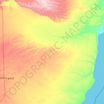
Name: Bari topographic map, elevation, terrain.
Location: Bari, Iskushuban, Bari, Puntland, Somalia (9.00000 49.00000 11.00000 51.00000)
Average elevation: 1,650 ft
Minimum elevation: -7 ft
Maximum elevation: 5,873 ft
Make a donation
Gear up for your next adventure:
As an Amazon Associate, this site earns from qualifying purchases at no extra cost to you.