Geolocate

mankot topographic map

Click on the map to display elevation.

About this map

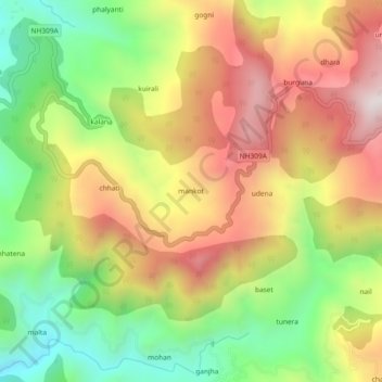
Name: mankot topographic map, elevation, terrain.

Location: mankot, Bāgeshwar, Bageshwar, Uttarakhand, 263642, India (29.80972 79.79394 29.84972 79.83394)

Average elevation: 4,281 ft

Minimum elevation: 2,920 ft

Maximum elevation: 5,709 ft

Gear up for your next adventure:

🧢Sun Protection Hats - Wide-brimmed and UPF-rated hats for high-altitude sun safety
🧥Waterproof Jacket for Hiking - Breathable and rugged rain jacket for outdoor excursions
📚USA Hiking Guide Books - Top trail guides and map books
🪶LED Camping Lantern - Bright lantern for camp lighting
🦟Ultrasonic Repellers - Create a bug-free zone at your camp or rest stop

As an Amazon Associate, this site earns from qualifying purchases at no extra cost to you.