
Xian autonome li de Ledong topographic map
Interactive map
Click on the map to display elevation.
About this map
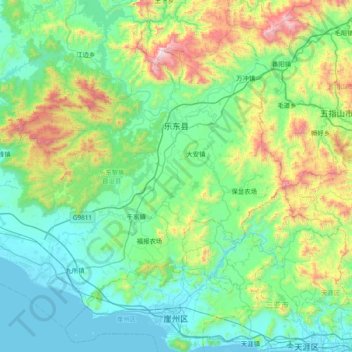
Name: Xian autonome li de Ledong topographic map, elevation, terrain.
Location: Xian autonome li de Ledong, Hainan, Chine (18.33696 108.64666 18.95680 109.40288)
Average elevation: 1,079 ft
Minimum elevation: 0 ft
Maximum elevation: 5,315 ft
Other topographic maps
Click on a map to view its topography, its elevation and its terrain.