Geolocate

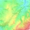
Somorrostro topographic map

Click on the map to display elevation.

About this map

Name: Somorrostro topographic map, elevation, terrain.

Location: Somorrostro, Las Serillas, Sexmo de Segovia, Comunidad de Ciudad y Tierra de Segovia, Segovia, Castilla y León, 40001, España (40.94563 -4.15422 40.96563 -4.13422)

Average elevation: 3,166 ft

Minimum elevation: 2,943 ft

Maximum elevation: 3,350 ft

Other topographic maps

Click on a map to view its topography, its elevation and its terrain.
Perogordo

España > Castilla y León > Segovia > Madrona

Average elevation: 3,209 ft

Fuentemilanos

España > Castilla y León > Segovia

Average elevation: 3,317 ft

Plaza de la Merced

España > Castilla y León > Segovia

Average elevation: 3,225 ft

Plaza San Nicolás

España > Castilla y León > Segovia

Average elevation: 3,255 ft

Fuentemilanos

España > Castilla y León > Segovia

Average elevation: 3,317 ft

Gear up for your next adventure:

📡GPS Antenna Upgrade - Enhance GPS reception in remote terrain
🎒Trekking Poles - Sturdy poles for balance and stability on rough terrain
🦶Carbon Trekking Poles - Reduce knee impact on steep descents with ultra-light poles
🎒Outdoor Daypacks - Lightweight backpacks designed for carrying maps and essential gear
🏕️Family Camping Gear - Essentials for group camping trips

As an Amazon Associate, this site earns from qualifying purchases at no extra cost to you.