
Thank you for supporting this site ❤️
Make a donation
Make a donation
Gear up for your next adventure:
As an Amazon Associate, this site earns from qualifying purchases at no extra cost to you.
Urdilde topographic map
Click on the map to display elevation.
Thank you for supporting this site ❤️
Make a donation
Make a donation
Gear up for your next adventure:
As an Amazon Associate, this site earns from qualifying purchases at no extra cost to you.
About this map
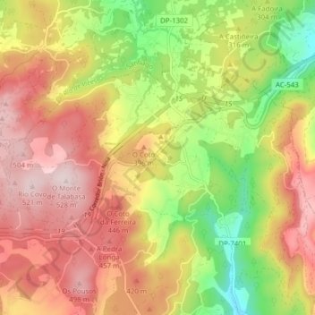
Name: Urdilde topographic map, elevation, terrain.
Location: Urdilde, A Calle, Rois, Sar, La Coruña, Galicia, España (42.80676 -8.77872 42.84314 -8.69855)
Average elevation: 1,089 ft
Minimum elevation: 315 ft
Maximum elevation: 1,719 ft
Thank you for supporting this site ❤️
Make a donation
Make a donation
Gear up for your next adventure:
As an Amazon Associate, this site earns from qualifying purchases at no extra cost to you.
Other topographic maps
Click on a map to view its topography, its elevation and its terrain.