
Thank you for supporting this site ❤️
Make a donation
Make a donation
Gear up for your next adventure:
As an Amazon Associate, this site earns from qualifying purchases at no extra cost to you.
Zacapalco topographic map
Click on the map to display elevation.
Thank you for supporting this site ❤️
Make a donation
Make a donation
Gear up for your next adventure:
As an Amazon Associate, this site earns from qualifying purchases at no extra cost to you.
About this map
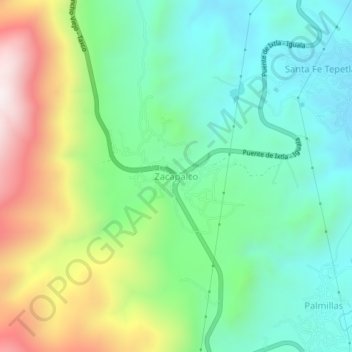
Name: Zacapalco topographic map, elevation, terrain.
Location: Zacapalco, Buenavista de Cuéllar, Guerrero, 40000, México (18.51722 -99.46324 18.55722 -99.42324)
Average elevation: 4,285 ft
Minimum elevation: 3,373 ft
Maximum elevation: 6,145 ft
Thank you for supporting this site ❤️
Make a donation
Make a donation
Gear up for your next adventure:
As an Amazon Associate, this site earns from qualifying purchases at no extra cost to you.