Geolocate

Azteca topographic map

Click on the map to display elevation.

About this map

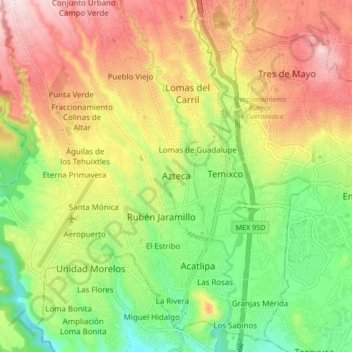
Name: Azteca topographic map, elevation, terrain.

Location: Azteca, Temixco, Morelos, 62580, Mexico (18.80451 -99.27545 18.88451 -99.19545)

Average elevation: 4,216 ft

Minimum elevation: 3,648 ft

Maximum elevation: 4,862 ft

Gear up for your next adventure:

🚪Portable Camp Chair - Foldable chair for comfort at camp
Solar GPS Watches - Advanced multisport watches with built-in topographic maps
🛌Ultralight Sleeping Bags - Compact down bags for cold nights in the wilderness
🔋Rechargeable Batteries - Power up your outdoor devices
🧯Emergency Survival Kit - All‑in‑one survival essentials for the backcountry

As an Amazon Associate, this site earns from qualifying purchases at no extra cost to you.