
Thank you for supporting this site ❤️
Make a donation
Make a donation
Gear up for your next adventure:
As an Amazon Associate, this site earns from qualifying purchases at no extra cost to you.
santiago topographic map
Click on the map to display elevation.
Thank you for supporting this site ❤️
Make a donation
Make a donation
Gear up for your next adventure:
As an Amazon Associate, this site earns from qualifying purchases at no extra cost to you.
About this map
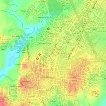
Name: santiago topographic map, elevation, terrain.
Location: santiago, Santiago, Distrito Santiago, Veraguas, Panamá (8.09283 -80.98748 8.11114 -80.97160)
Average elevation: 292 ft
Minimum elevation: 171 ft
Maximum elevation: 377 ft
Thank you for supporting this site ❤️
Make a donation
Make a donation
Gear up for your next adventure:
As an Amazon Associate, this site earns from qualifying purchases at no extra cost to you.