

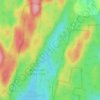
West Rutland topographic map
Click on the map to display elevation.
West Rutland
The town of Rutland was originally granted in 1761 as one of the New Hampshire Grants and named after Rutland, Massachusetts, the home of the first grantee, John Murrey. It was one of the most successful of those grants because of excellent farmland and gentle topography.
About this map

Name: West Rutland topographic map, elevation, terrain.
Location: West Rutland, Rutland County, Vermont, 05777, United States (43.57019 -73.10454 43.66511 -73.00953)
Average elevation: 879 ft
Minimum elevation: 361 ft
Maximum elevation: 2,339 ft
Rutland County trails, hiking, mountain biking, running and outdoor activities
Other topographic maps
Click on a map to view its topography, its elevation and its terrain.



Brookside Trailer Park
United States > Vermont > Rutland County > Rutland City
Average elevation: 650 ft




Chittenden Reservoir
United States > Vermont > Rutland County > Chittenden
Average elevation: 1,552 ft
Billings Mobile Manor
United States > Vermont > Rutland County > Rutland City
Average elevation: 692 ft