Geolocate

Pongo de Caynarachi topographic map

Click on the map to display elevation.

About this map

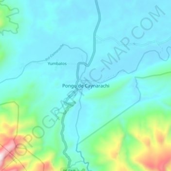
Name: Pongo de Caynarachi topographic map, elevation, terrain.

Location: Pongo de Caynarachi, Caynarachi, Lamas, San Martín, Perú (-6.37060 -76.32421 -6.29060 -76.24421)

Average elevation: 1,115 ft

Minimum elevation: 558 ft

Maximum elevation: 3,927 ft

Gear up for your next adventure:

🥘Titanium Cookware - Durable, featherlight pots and pans for backpacking
🔭Telescopic Hiking Pole - Adjustable pole for hiking stability
Backpacking Tent - Lightweight and durable tent for multi‑day hikes
🛶Inflatable Kayak - Portable kayak for rivers, lakes, and expeditions
🗺️NatGeo Topo Maps - High-quality waterproof printed topographic maps of US Parks

As an Amazon Associate, this site earns from qualifying purchases at no extra cost to you.