
Luizi topographic map
Interactive map
Click on the map to display elevation.
About this map
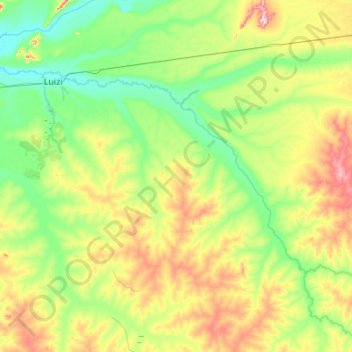
Name: Luizi topographic map, elevation, terrain.
Location: Luizi, Tanganyika, DR Congo (-6.35938 27.30525 -6.01616 27.84731)
Average elevation: 2,182 ft
Minimum elevation: 1,844 ft
Maximum elevation: 2,976 ft
Other topographic maps
Click on a map to view its topography, its elevation and its terrain.