Geolocate

Manikaran topographic map

Click on the map to display elevation.

About this map
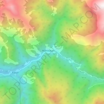
Name: Manikaran topographic map, elevation, terrain.

Location: Manikaran, Bhuntar, Kullu, Himachal Pradesh, 175105, India (31.98732 77.30641 32.06732 77.38641)

Average elevation: 8,665 ft

Minimum elevation: 4,967 ft

Maximum elevation: 14,301 ft

Gear up for your next adventure:

🧭Orienteering Set - Complete compass and map reading kit
🛰️Satellite Messengers - Emergency SOS and two-way messaging for off-grid adventures
🎒Waterproof Dry Bags - Keep your electronics and maps dry inside your pack
🛶Inflatable Kayak - Portable kayak for rivers, lakes, and expeditions
🎒Day Hiking Backpack - Lightweight backpack perfect for day trips and outdoor adventures

As an Amazon Associate, this site earns from qualifying purchases at no extra cost to you.