Geolocate

Manikaran topographic map

Click on the map to display elevation.

About this map

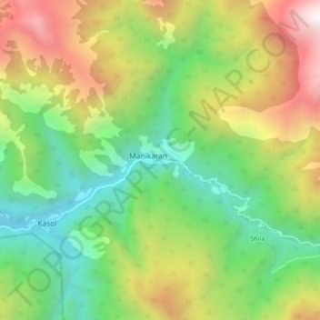
Name: Manikaran topographic map, elevation, terrain.

Location: Manikaran, Bhuntar, Kullu, Himachal Pradesh, 175105, India (31.98732 77.30641 32.06732 77.38641)

Average elevation: 8,665 ft

Minimum elevation: 4,967 ft

Maximum elevation: 14,301 ft

Gear up for your next adventure:

🛠️Backpacking Tool Kit - Essential toolkit for outdoor repairs
🏥Hiking First Aid Kits - Comprehensive medical kits for remote trail injuries
🔥Camping Stove - Portable stove for camping and backcountry cooking
🚗GPS Dash Cams - Record your scenic drives through mountain passes and canyons
🪶Camping Sleeping Pad - Comfortable sleeping pad for backpacking

As an Amazon Associate, this site earns from qualifying purchases at no extra cost to you.