Geolocate

Watukelir topographic map

Click on the map to display elevation.

About this map

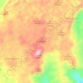
Name: Watukelir topographic map, elevation, terrain.

Location: Watukelir, Kebumen, Central Java, Java, Indonesia (-7.72609 109.42716 -7.68609 109.46716)

Average elevation: 1,004 ft

Minimum elevation: 240 ft

Maximum elevation: 1,486 ft

Gear up for your next adventure:

📷Action Camera - Capture your outdoor adventures in HD
🪶Thermal Camp Blanket - Extra warmth for cold nights
🥾Men's Hiking Boots - Durable, waterproof footwear for rugged terrain and steep inclines
❄️Traction Cleats - Prevent slips on icy trails during winter hikes
🥘Titanium Cookware - Durable, featherlight pots and pans for backpacking

As an Amazon Associate, this site earns from qualifying purchases at no extra cost to you.