
Thank you for supporting this site ❤️
Make a donation
Make a donation
Gear up for your next adventure:
As an Amazon Associate, this site earns from qualifying purchases at no extra cost to you.
Xiannushan topographic map
Click on the map to display elevation.
Thank you for supporting this site ❤️
Make a donation
Make a donation
Gear up for your next adventure:
As an Amazon Associate, this site earns from qualifying purchases at no extra cost to you.
About this map
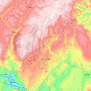
Name: Xiannushan topographic map, elevation, terrain.
Location: Xiannushan, Wulong District, 渝东南武陵山区城镇群区位, Chongqing, China (29.35669 107.67799 29.56587 107.84472)
Average elevation: 4,154 ft
Minimum elevation: 541 ft
Maximum elevation: 6,440 ft
Thank you for supporting this site ❤️
Make a donation
Make a donation
Gear up for your next adventure:
As an Amazon Associate, this site earns from qualifying purchases at no extra cost to you.