
Thank you for supporting this site ❤️
Make a donation
Make a donation
Gear up for your next adventure:
As an Amazon Associate, this site earns from qualifying purchases at no extra cost to you.
Wernberg topographic map
Click on the map to display elevation.
Thank you for supporting this site ❤️
Make a donation
Make a donation
Gear up for your next adventure:
As an Amazon Associate, this site earns from qualifying purchases at no extra cost to you.
About this map
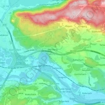
Name: Wernberg topographic map, elevation, terrain.
Location: Wernberg, Bezirk Villach-Land, Carinthia, 9241, Austria (46.59065 13.92195 46.65517 14.00251)
Average elevation: 1,942 ft
Minimum elevation: 1,558 ft
Maximum elevation: 2,871 ft
Thank you for supporting this site ❤️
Make a donation
Make a donation
Gear up for your next adventure:
As an Amazon Associate, this site earns from qualifying purchases at no extra cost to you.