Geolocate

Healy topographic map

Click on the map to display elevation.

About this map

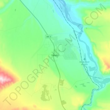
Name: Healy topographic map, elevation, terrain.

Location: Healy, Denali Borough, Alaska, 99743, United States (63.82964 -149.05919 63.90964 -148.97919)

Average elevation: 1,588 ft

Minimum elevation: 1,165 ft

Maximum elevation: 2,762 ft

Denali Borough trails, hiking, mountain biking, running and outdoor activities

Gear up for your next adventure:

🕶️GPS Smartphone Mount - Secure mount for phone navigation
🎒Hydration Pack - Hands‑free water reservoir for long hikes
🦶Carbon Trekking Poles - Reduce knee impact on steep descents with ultra-light poles
🪶Thermal Camp Blanket - Extra warmth for cold nights
🏫Relief Map Kits - Hands-on tools for teaching landforms and elevation

As an Amazon Associate, this site earns from qualifying purchases at no extra cost to you.