
Thank you for supporting this site ❤️
Make a donation
Make a donation
Gear up for your next adventure:
As an Amazon Associate, this site earns from qualifying purchases at no extra cost to you.
Chrudim topographic map
Click on the map to display elevation.
Thank you for supporting this site ❤️
Make a donation
Make a donation
Gear up for your next adventure:
As an Amazon Associate, this site earns from qualifying purchases at no extra cost to you.
About this map
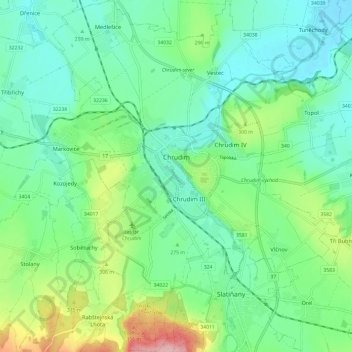
Name: Chrudim topographic map, elevation, terrain.
Location: Chrudim, okres Chrudim, Pardubický kraj, Northeast, Czechia (49.90858 15.74728 49.98531 15.86129)
Average elevation: 906 ft
Minimum elevation: 764 ft
Maximum elevation: 1,280 ft
Thank you for supporting this site ❤️
Make a donation
Make a donation
Gear up for your next adventure:
As an Amazon Associate, this site earns from qualifying purchases at no extra cost to you.