
Thank you for supporting this site ❤️
Make a donation
Make a donation
Gear up for your next adventure:
As an Amazon Associate, this site earns from qualifying purchases at no extra cost to you.
Beringen topographic map
Click on the map to display elevation.
Thank you for supporting this site ❤️
Make a donation
Make a donation
Gear up for your next adventure:
As an Amazon Associate, this site earns from qualifying purchases at no extra cost to you.
About this map
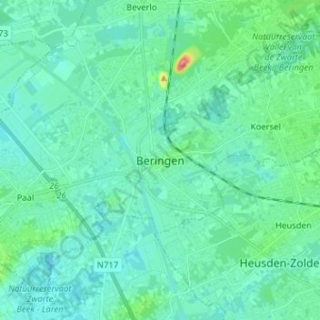
Name: Beringen topographic map, elevation, terrain.
Location: Beringen, Hasselt, Limburg, Vlaanderen, 3580, België (51.00896 5.18669 51.08896 5.26669)
Average elevation: 115 ft
Minimum elevation: 59 ft
Maximum elevation: 413 ft
Thank you for supporting this site ❤️
Make a donation
Make a donation
Gear up for your next adventure:
As an Amazon Associate, this site earns from qualifying purchases at no extra cost to you.