
Thank you for supporting this site ❤️
Make a donation
Make a donation
Gear up for your next adventure:
As an Amazon Associate, this site earns from qualifying purchases at no extra cost to you.
Berden topographic map
Click on the map to display elevation.
Thank you for supporting this site ❤️
Make a donation
Make a donation
Gear up for your next adventure:
As an Amazon Associate, this site earns from qualifying purchases at no extra cost to you.
About this map
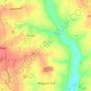
Name: Berden topographic map, elevation, terrain.
Location: Berden, Uttlesford, Essex, England, United Kingdom (51.92998 0.11471 51.95583 0.17632)
Average elevation: 341 ft
Minimum elevation: 223 ft
Maximum elevation: 430 ft
Thank you for supporting this site ❤️
Make a donation
Make a donation
Gear up for your next adventure:
As an Amazon Associate, this site earns from qualifying purchases at no extra cost to you.
Other topographic maps
Click on a map to view its topography, its elevation and its terrain.
Coles Green
United Kingdom > England > Essex > Uttlesford > Berden > Little London
Average elevation: 328 ft