Geolocate

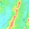
Calera topographic map

Click on the map to display elevation.

About this map

Name: Calera topographic map, elevation, terrain.

Location: Calera, Shelby County, Alabama, 35040, United States (33.05818 -86.81228 33.19018 -86.65568)

Average elevation: 551 ft

Minimum elevation: 243 ft

Maximum elevation: 715 ft

Shelby County trails, hiking, mountain biking, running and outdoor activities

Other topographic maps

Click on a map to view its topography, its elevation and its terrain.
Scottsdale

United States > Alabama > Shelby County > Alabaster

Average elevation: 551 ft

Valley Forge

United States > Alabama > Shelby County > Alabaster

Average elevation: 499 ft

Maylene

United States > Alabama > Shelby County > Alabaster

Average elevation: 587 ft

Meadowbrook

United States > Alabama > Shelby County

Average elevation: 630 ft

Chandalar South

United States > Alabama > Shelby County > Pelham

Average elevation: 525 ft

Abbot Springs

United States > Alabama > Shelby County > Westover

Average elevation: 535 ft

Lawley

United States > Alabama > Shelby County

Average elevation: 551 ft

Lake Purdy

United States > Alabama > Shelby County > Brook Highland

Average elevation: 614 ft

Indian Shoals

United States > Alabama > Shelby County > Wilsonville

Average elevation: 433 ft

Westover

United States > Alabama > Shelby County

Average elevation: 502 ft

Hardy

United States > Alabama > Shelby County > Alabaster

Average elevation: 515 ft

Meadowbrook

United States > Alabama > Shelby County > Meadowbrook

Average elevation: 630 ft

Gear up for your next adventure:

📡Handheld GPS Device - Reliable handheld GPS for outdoor navigation
🥇GPS Hiking Watch - Multi‑sport GPS watch with navigation and trail tracking
🛏️Cold Weather Sleeping Bag - Warm sleeping bag for cold conditions
🏕️Tent Footprint - Protect your tent base from wear
🪑Ultralight Camp Chairs - Portable seating for resting after a long day of mapping

As an Amazon Associate, this site earns from qualifying purchases at no extra cost to you.