Geolocate

Sector 6 topographic map

Click on the map to display elevation.

About this map

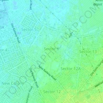
Name: Sector 6 topographic map, elevation, terrain.

Location: Sector 6, Gurgaon, Gurugram, Haryana, India (28.46770 77.01792 28.48144 77.03202)

Average elevation: 728 ft

Minimum elevation: 712 ft

Maximum elevation: 748 ft

Other topographic maps

Click on a map to view its topography, its elevation and its terrain.

Sohna

India > Haryana > Gurugram

Average elevation: 751 ft

Ghamroj

India > Haryana > Gurugram

Average elevation: 804 ft

Gear up for your next adventure:

🔥Fast-Boil Camping Stoves - Efficient cooking systems for quick trail meals
🗃️Trail First Aid Kit - Essential kit for outdoor injuries and emergencies
🧭Pro Hiking Compasses - High-accuracy liquid-filled compasses for topographic orientation
🥾Men's Hiking Boots - Durable, waterproof footwear for rugged terrain and steep inclines
🚑Emergency Bivvies - Heat-reflective sleeping bags for survival situations

As an Amazon Associate, this site earns from qualifying purchases at no extra cost to you.