Geolocate

Bells Mill topographic map

Click on the map to display elevation.

About this map

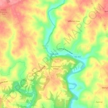
Name: Bells Mill topographic map, elevation, terrain.

Location: Bells Mill, Frederick County, Maryland, 21755, United States (39.31288 -77.59749 39.35288 -77.55749)

Average elevation: 394 ft

Minimum elevation: 226 ft

Maximum elevation: 522 ft

Frederick County trails, hiking, mountain biking, running and outdoor activities

Gear up for your next adventure:

📖Nature Tracking Books - Learn to track wildlife and terrain
🧭Map Reading Tools - Tools and kits for map navigation
🚑Emergency Bivvies - Heat-reflective sleeping bags for survival situations
🪵Folding Camp Saw - Compact saw for wood and campsite work
🗺️Topographic Maps - Detailed topo maps for hiking, exploring and outdoor navigation

As an Amazon Associate, this site earns from qualifying purchases at no extra cost to you.