Geolocate

Keesara topographic map

Click on the map to display elevation.

About this map

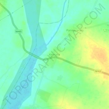
Name: Keesara topographic map, elevation, terrain.

Location: Keesara, Kanchikacherla, Krishna, Andhra Pradesh, India (16.69911 80.30487 16.73911 80.34487)

Average elevation: 128 ft

Minimum elevation: 92 ft

Maximum elevation: 187 ft

Gear up for your next adventure:

🦺Reflective Outdoor Gear - Safety gear for low‑light conditions
🪶Paracord Bracelet - Survival bracelet with built‑in tools
😴Insulated Sleeping Pads - Compact and warm pads for high-elevation camping
🛰️Satellite Messengers - Emergency SOS and two-way messaging for off-grid adventures
🧣Hiking Neck Gaiter - Multi‑use neck protection for outdoor weather

As an Amazon Associate, this site earns from qualifying purchases at no extra cost to you.