
Thank you for supporting this site ❤️
Make a donation
Make a donation
Gear up for your next adventure:
As an Amazon Associate, this site earns from qualifying purchases at no extra cost to you.
Niederlommatzsch topographic map
Click on the map to display elevation.
Thank you for supporting this site ❤️
Make a donation
Make a donation
Gear up for your next adventure:
As an Amazon Associate, this site earns from qualifying purchases at no extra cost to you.
About this map
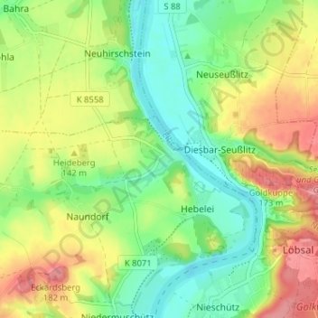
Name: Niederlommatzsch topographic map, elevation, terrain.
Location: Niederlommatzsch, Diera-Zehren, Meißen, Sachsen, Deutschland (51.21894 13.38599 51.25894 13.42599)
Average elevation: 420 ft
Minimum elevation: 295 ft
Maximum elevation: 587 ft
Thank you for supporting this site ❤️
Make a donation
Make a donation
Gear up for your next adventure:
As an Amazon Associate, this site earns from qualifying purchases at no extra cost to you.