
Thank you for supporting this site ❤️
Make a donation
Make a donation
Gear up for your next adventure:
As an Amazon Associate, this site earns from qualifying purchases at no extra cost to you.
Pangada topographic map
Click on the map to display elevation.
Thank you for supporting this site ❤️
Make a donation
Make a donation
Gear up for your next adventure:
As an Amazon Associate, this site earns from qualifying purchases at no extra cost to you.
About this map
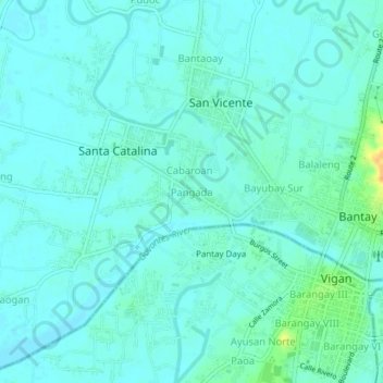
Name: Pangada topographic map, elevation, terrain.
Location: Pangada, Ilocos Sur, Ilocos Region, 2700, Philippines (17.56453 120.35141 17.60453 120.39141)
Average elevation: 20 ft
Minimum elevation: 0 ft
Maximum elevation: 102 ft
Thank you for supporting this site ❤️
Make a donation
Make a donation
Gear up for your next adventure:
As an Amazon Associate, this site earns from qualifying purchases at no extra cost to you.