
Make a donation
Gear up for your next adventure:
As an Amazon Associate, this site earns from qualifying purchases at no extra cost to you.
Izmail topographic map
Click on the map to display elevation.
Make a donation
Gear up for your next adventure:
As an Amazon Associate, this site earns from qualifying purchases at no extra cost to you.
Izmail
Under the Köppen classification, Izmail has a humid continental climate (Dfa) with four distinct seasons and generous precipitation year-round, typical for the inland South. Summers are hot and humid, with temperatures somewhat moderated by the city's elevation. Winters are cool but variable, with an average of 48 freezing days per year.
Make a donation
Gear up for your next adventure:
As an Amazon Associate, this site earns from qualifying purchases at no extra cost to you.
About this map
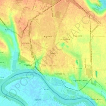
Name: Izmail topographic map, elevation, terrain.
Average elevation: 62 ft
Minimum elevation: -7 ft
Maximum elevation: 118 ft
Make a donation
Gear up for your next adventure:
As an Amazon Associate, this site earns from qualifying purchases at no extra cost to you.