Geolocate

Oak Drive topographic map

Click on the map to display elevation.

About this map

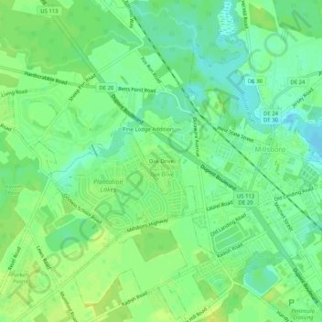
Name: Oak Drive topographic map, elevation, terrain.

Location: Oak Drive, Sussex County, Delaware, United States (38.57002 -75.32863 38.61002 -75.28863)

Average elevation: 30 ft

Minimum elevation: 0 ft

Maximum elevation: 52 ft

Sussex County trails, hiking, mountain biking, running and outdoor activities

Gear up for your next adventure:

🎒Trekking Poles - Sturdy poles for balance and stability on rough terrain
🧭Orienteering Set - Complete compass and map reading kit
🧭Map Reading Tools - Tools and kits for map navigation
🎒Outdoor Daypacks - Lightweight backpacks designed for carrying maps and essential gear
🧭Pro Hiking Compasses - High-accuracy liquid-filled compasses for topographic orientation

As an Amazon Associate, this site earns from qualifying purchases at no extra cost to you.