Geolocate

Chilli topographic map

Click on the map to display elevation.

About this map

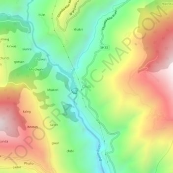
Name: Chilli topographic map, elevation, terrain.

Location: Chilli, Chaurah, Chamba, Himachal Pradesh, India (32.78781 76.12500 32.82781 76.16500)

Average elevation: 5,105 ft

Minimum elevation: 3,350 ft

Maximum elevation: 7,365 ft

Gear up for your next adventure:

🔌Solar Panel Charger - Charge gear sustainably outdoors
🧯Portable Fire Pit - Compact fire pit for camping spots
🌐World Map Poster - Decorative world maps with topographic info
🔋Rechargeable Batteries - Power up your outdoor devices
🧭Hiking Compass - Precision compass for reliable navigation in the wilderness

As an Amazon Associate, this site earns from qualifying purchases at no extra cost to you.