Geolocate

Witheren topographic map

Click on the map to display elevation.

About this map

Name: Witheren topographic map, elevation, terrain.

Location: Witheren, Canungra, Queensland, Australia (-28.08986 153.12065 -27.98265 153.23888)

Average elevation: 784 ft

Minimum elevation: 128 ft

Maximum elevation: 1,847 ft

Other topographic maps

Click on a map to view its topography, its elevation and its terrain.
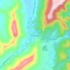
Canungra

Australia > Queensland > Canungra

Average elevation: 712 ft

Gear up for your next adventure:

🔥Fast-Boil Camping Stoves - Efficient cooking systems for quick trail meals
🔭Telescopic Hiking Pole - Adjustable pole for hiking stability
🛰️Handheld GPS Units - Professional satellite navigators for precise backcountry mapping
🖼️Topo Map Wall Art - Decorative topographic prints of famous peaks and regions
🥇GPS Hiking Watch - Multi‑sport GPS watch with navigation and trail tracking

As an Amazon Associate, this site earns from qualifying purchases at no extra cost to you.