
Thank you for supporting this site ❤️
Make a donation
Make a donation
Gear up for your next adventure:
As an Amazon Associate, this site earns from qualifying purchases at no extra cost to you.
Butembo topographic map
Click on the map to display elevation.
Thank you for supporting this site ❤️
Make a donation
Make a donation
Gear up for your next adventure:
As an Amazon Associate, this site earns from qualifying purchases at no extra cost to you.
About this map
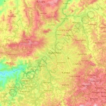
Name: Butembo topographic map, elevation, terrain.
Location: Butembo, North Kivu, 000, Democratic Republic of the Congo (0.05363 29.20519 0.19533 29.37369)
Average elevation: 5,863 ft
Minimum elevation: 4,606 ft
Maximum elevation: 7,028 ft
Thank you for supporting this site ❤️
Make a donation
Make a donation
Gear up for your next adventure:
As an Amazon Associate, this site earns from qualifying purchases at no extra cost to you.