Geolocate

Bolpur topographic map

Click on the map to display elevation.

About this map

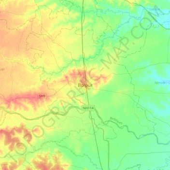
Name: Bolpur topographic map, elevation, terrain.

Location: Bolpur, Bolpur Sriniketan, Birbhum, West Bengal, 731204, India (23.50115 87.53624 23.82115 87.85624)

Average elevation: 138 ft

Minimum elevation: 72 ft

Maximum elevation: 243 ft

Gear up for your next adventure:

🦟Ultrasonic Repellers - Create a bug-free zone at your camp or rest stop
🧥Waterproof Jacket for Hiking - Breathable and rugged rain jacket for outdoor excursions
🛰️Satellite Messengers - Emergency SOS and two-way messaging for off-grid adventures
👓Polarized Sunglasses - Outdoor sunglasses for glare reduction
🎒Hydration Pack - Hands‑free water reservoir for long hikes

As an Amazon Associate, this site earns from qualifying purchases at no extra cost to you.