Geolocate

Hopewell topographic map

Click on the map to display elevation.

About this map

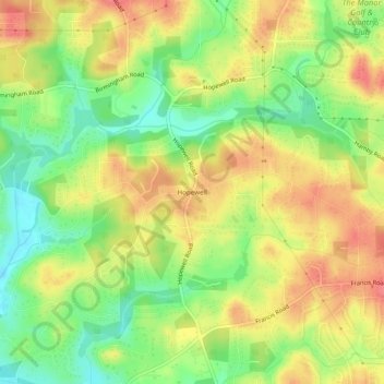
Name: Hopewell topographic map, elevation, terrain.

Location: Hopewell, Milton, Fulton County, Georgia, United States (34.13287 -84.30548 34.17287 -84.26548)

Average elevation: 1,066 ft

Minimum elevation: 948 ft

Maximum elevation: 1,171 ft

Fulton County trails, hiking, mountain biking, running and outdoor activities

Gear up for your next adventure:

🗺️NatGeo Topo Maps - High-quality waterproof printed topographic maps of US Parks
🪶Survival Guide Book - Expert advice for emergency preparedness
🧭Map Reading Tools - Tools and kits for map navigation
🧦Hiking Socks - Comfortable socks to prevent blisters on long hikes
🔊Portable Camp Speaker - Music and alerts at camp

As an Amazon Associate, this site earns from qualifying purchases at no extra cost to you.