
Trento topographic map
Click on the map to display elevation.
Trento
Trento has a humid subtropical-continental climate (Cfa-Dfa) through most of its populated areas according to the Köppen climate classification. Boroughs at higher elevation like Viote have a colder alpine climate (Dw). Monthly average temperatures range between 1.6 °C (January) and 23.4 °C (July). Annual precipitation exceed 900 mm spread out on an average of 87 days, with peaks in late spring (May–June, 90 mm monthly average in 9–10 rain days) and autumn (October–November: 100–110 mm monthly average in 7–8 days), and lows in winter (January–February, 30–40 mm monthly average in 3–4 rain days).
About this map
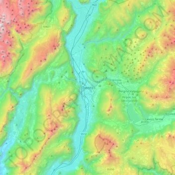
Name: Trento topographic map, elevation, terrain.
Average elevation: 3,182 ft
Minimum elevation: 305 ft
Maximum elevation: 10,226 ft