Geolocate

Bankerohan Sur topographic map

Click on the map to display elevation.

About this map

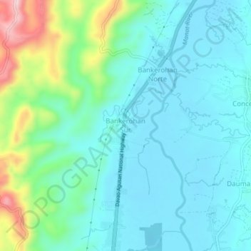
Name: Bankerohan Sur topographic map, elevation, terrain.

Location: Bankerohan Sur, Davao de Oro, Davao Region, 8801, Philippines (7.70994 125.97253 7.74994 126.01253)

Average elevation: 377 ft

Minimum elevation: 194 ft

Maximum elevation: 1,050 ft

Gear up for your next adventure:

🪑Ultralight Camp Chairs - Portable seating for resting after a long day of mapping
🧭Outdoor Navigation Book - Learn advanced navigation skills
🎒Waterproof Dry Bags - Keep your electronics and maps dry inside your pack
🏕️Family Camping Gear - Essentials for group camping trips
Backpacking Tents - Weight-optimized shelters for multi-day topographic surveys

As an Amazon Associate, this site earns from qualifying purchases at no extra cost to you.