
Thank you for supporting this site ❤️
Make a donation
Make a donation
Gear up for your next adventure:
As an Amazon Associate, this site earns from qualifying purchases at no extra cost to you.
Boujafar Beach topographic map
Click on the map to display elevation.
Thank you for supporting this site ❤️
Make a donation
Make a donation
Gear up for your next adventure:
As an Amazon Associate, this site earns from qualifying purchases at no extra cost to you.
About this map
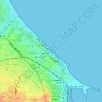
Name: Boujafar Beach topographic map, elevation, terrain.
Location: Boujafar Beach, بوجعفر, معتمدية سوسة المدينة, Sousse, Tunisia (35.83330 10.63168 35.84088 10.64156)
Average elevation: 30 ft
Minimum elevation: -10 ft
Maximum elevation: 144 ft
Thank you for supporting this site ❤️
Make a donation
Make a donation
Gear up for your next adventure:
As an Amazon Associate, this site earns from qualifying purchases at no extra cost to you.