Geolocate

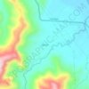
Camarones topographic map

Click on the map to display elevation.

About this map

Name: Camarones topographic map, elevation, terrain.

Location: Camarones, Esmeraldas, Ecuador (0.87463 -79.59772 1.04839 -79.45111)

Average elevation: 440 ft

Minimum elevation: 0 ft

Maximum elevation: 2,041 ft

Other topographic maps

Click on a map to view its topography, its elevation and its terrain.
Tabuche

Ecuador > Esmeraldas > Esmeraldas

Average elevation: 436 ft

Gear up for your next adventure:

⛺Backpacking Tents - Weight-optimized shelters for multi-day topographic surveys
🗃️Trail First Aid Kit - Essential kit for outdoor injuries and emergencies
🧦Merino Wool Socks - Moisture-wicking, blister-preventing socks for long treks
🔋Rechargeable Batteries - Power up your outdoor devices
👟Trail Running Shoes - Lightweight shoes for trail runners

As an Amazon Associate, this site earns from qualifying purchases at no extra cost to you.