
Thank you for supporting this site ❤️
Make a donation
Make a donation
Gear up for your next adventure:
As an Amazon Associate, this site earns from qualifying purchases at no extra cost to you.
Chatsworth topographic map
Click on the map to display elevation.
Thank you for supporting this site ❤️
Make a donation
Make a donation
Gear up for your next adventure:
As an Amazon Associate, this site earns from qualifying purchases at no extra cost to you.
About this map
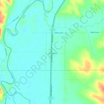
Name: Chatsworth topographic map, elevation, terrain.
Location: Chatsworth, Sioux County, Iowa, 51011, United States (42.89567 -96.53594 42.93567 -96.49594)
Average elevation: 1,178 ft
Minimum elevation: 1,135 ft
Maximum elevation: 1,302 ft
Thank you for supporting this site ❤️
Make a donation
Make a donation
Gear up for your next adventure:
As an Amazon Associate, this site earns from qualifying purchases at no extra cost to you.