
Thank you for supporting this site ❤️
Make a donation
Make a donation
Gear up for your next adventure:
As an Amazon Associate, this site earns from qualifying purchases at no extra cost to you.
Cohana topographic map
Click on the map to display elevation.
Thank you for supporting this site ❤️
Make a donation
Make a donation
Gear up for your next adventure:
As an Amazon Associate, this site earns from qualifying purchases at no extra cost to you.
About this map
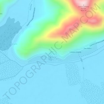
Name: Cohana topographic map, elevation, terrain.
Location: Cohana, Pucarani, Provincia Los Andes, La Paz, Bolivia (-16.37174 -68.66690 -16.36573 -68.64786)
Average elevation: 12,726 ft
Minimum elevation: 12,520 ft
Maximum elevation: 13,727 ft
Thank you for supporting this site ❤️
Make a donation
Make a donation
Gear up for your next adventure:
As an Amazon Associate, this site earns from qualifying purchases at no extra cost to you.