
Thank you for supporting this site ❤️
Make a donation
Make a donation
Gear up for your next adventure:
As an Amazon Associate, this site earns from qualifying purchases at no extra cost to you.
Salinas topographic map
Click on the map to display elevation.
Thank you for supporting this site ❤️
Make a donation
Make a donation
Gear up for your next adventure:
As an Amazon Associate, this site earns from qualifying purchases at no extra cost to you.
About this map
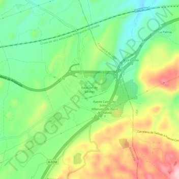
Name: Salinas topographic map, elevation, terrain.
Location: Salinas, Archidona, Nororma, Málaga, Andalucía, 29315, España (37.10423 -4.31931 37.14423 -4.27931)
Average elevation: 2,507 ft
Minimum elevation: 2,234 ft
Maximum elevation: 2,913 ft
Thank you for supporting this site ❤️
Make a donation
Make a donation
Gear up for your next adventure:
As an Amazon Associate, this site earns from qualifying purchases at no extra cost to you.