Geolocate

Ram Nagar topographic map

Click on the map to display elevation.

About this map

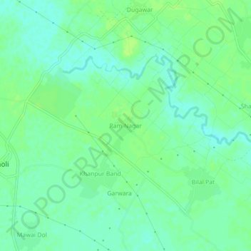
Name: Ram Nagar topographic map, elevation, terrain.

Location: Ram Nagar, Sambhal, Uttar Pradesh, India (28.68112 78.53662 28.72112 78.57662)

Average elevation: 669 ft

Minimum elevation: 646 ft

Maximum elevation: 686 ft

Gear up for your next adventure:

🔥Camping Stove - Portable stove for camping and backcountry cooking
🌡️Handheld Weather Meters - Measure wind, temp, and pressure for safe mountain travel
📶Vehicle Signal Boosters - Improve reception in rural areas while driving to trailheads
🥤Water Filter Bottle - All‑in‑one filter bottle for safe hydration
🧥Men's Rain Shells - Premium waterproof and breathable jackets for mountain weather

As an Amazon Associate, this site earns from qualifying purchases at no extra cost to you.