Geolocate

Prestonsburg topographic map

Click on the map to display elevation.

About this map

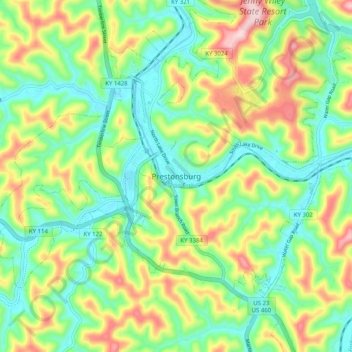
Name: Prestonsburg topographic map, elevation, terrain.

Location: Prestonsburg, Floyd County, Kentucky, 41653, United States (37.62565 -82.81155 37.70565 -82.73155)

Average elevation: 899 ft

Minimum elevation: 594 ft

Maximum elevation: 1,427 ft

Floyd County trails, hiking, mountain biking, running and outdoor activities

Gear up for your next adventure:

🦶Hiking Gaiters - Keep debris and water out of your boots
🛰️Satellite Messengers - Emergency SOS and two-way messaging for off-grid adventures
🦶Carbon Trekking Poles - Reduce knee impact on steep descents with ultra-light poles
🌲Outdoor Survival Books - Best books on survival skills
🎒Hydration Pack - Hands‑free water reservoir for long hikes

As an Amazon Associate, this site earns from qualifying purchases at no extra cost to you.