Geolocate

Mont-Joli topographic map

Click on the map to display elevation.

About this map

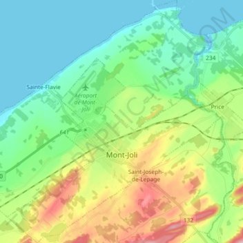
Name: Mont-Joli topographic map, elevation, terrain.

Location: Mont-Joli, La Mitis, Bas-Saint-Laurent, Quebec, Canada (48.54884 -68.25211 48.64440 -68.12504)

Average elevation: 207 ft

Minimum elevation: -13 ft

Maximum elevation: 702 ft

Gear up for your next adventure:

🔦Compact Flashlight - Reliable flashlight for emergencies
🧥Waterproof Jacket for Hiking - Breathable and rugged rain jacket for outdoor excursions
🎁Geography Themed Gifts - Unique gift ideas for map lovers and geography enthusiasts
Backpacking Tent - Lightweight and durable tent for multi‑day hikes
📶Satellite Messenger - Communication device off‑grid

As an Amazon Associate, this site earns from qualifying purchases at no extra cost to you.