Geolocate

Garda topographic map

Click on the map to display elevation.

About this map

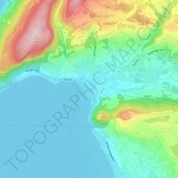
Name: Garda topographic map, elevation, terrain.

Location: Garda, Verona, Veneto, 37016, Italy (45.55565 10.68853 45.59565 10.72853)

Average elevation: 509 ft

Minimum elevation: 200 ft

Maximum elevation: 1,312 ft

Gear up for your next adventure:

🪑Portable Camp Table - Compact table for campsite meals
🔭Stargazing Telescopes - Perfect for camping in low-light pollution areas shown on maps
🛠️Outdoor Gear Repair Kit - Essential tools to fix gear on the trail
🔦Compact Flashlight - Reliable flashlight for emergencies
🕶️Glacier Sunglasses - Side shields to protect eyes from high-altitude snow glare

As an Amazon Associate, this site earns from qualifying purchases at no extra cost to you.