Geolocate

Frigiliana topographic map

Click on the map to display elevation.

About this map

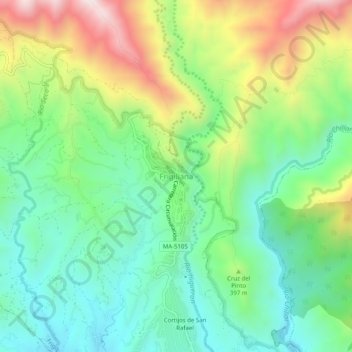
Name: Frigiliana topographic map, elevation, terrain.

Location: Frigiliana, La Axarquía, Malaga, Andalusia, 29788, Spain (36.77091 -3.91539 36.81091 -3.87539)

Average elevation: 1,076 ft

Minimum elevation: 243 ft

Maximum elevation: 2,648 ft

Gear up for your next adventure:

🪶Wildlife Field Guides - Learn animal tracking and species ID
🥾Women's Hiking Boots - Top-rated trail boots with ankle support and superior grip
📖Nature Tracking Books - Learn to track wildlife and terrain
🪶Camp Gear Gift Set - Perfect gift bundle for outdoor fans
🔭Compact Binoculars - HD vision for scouting terrain and identifying distant landmarks

As an Amazon Associate, this site earns from qualifying purchases at no extra cost to you.