Make a donation
Gear up for your next adventure:
As an Amazon Associate, this site earns from qualifying purchases at no extra cost to you.
Traubing topographic map
Click on the map to display elevation.
Make a donation
Gear up for your next adventure:
As an Amazon Associate, this site earns from qualifying purchases at no extra cost to you.
Traubing
Das Pfarrdorf Traubing liegt zwischen Ammer- und Starnberger See etwa zweieinhalb Kilometer südlich von Aschering, zweieinhalb Kilometer östlich von Machtlfing und westlich der Bundesstraße 2. Der Untergrund sind würmzeitliche End- und Seitenmoränen oder Schmelzwasserschotter auf einer Höhenlage zwischen 661 und 683 m ü. NN.
Make a donation
Gear up for your next adventure:
As an Amazon Associate, this site earns from qualifying purchases at no extra cost to you.
About this map
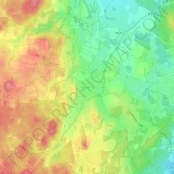
Name: Traubing topographic map, elevation, terrain.
Average elevation: 2,241 ft
Minimum elevation: 2,070 ft
Maximum elevation: 2,421 ft
Make a donation
Gear up for your next adventure:
As an Amazon Associate, this site earns from qualifying purchases at no extra cost to you.
