Geolocate

Point Pelee topographic map

Click on the map to display elevation.

About this map

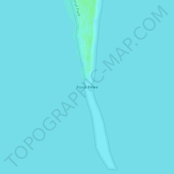
Name: Point Pelee topographic map, elevation, terrain.

Location: Point Pelee, Leamington, Essex County, Ontario, Canada (41.90881 -82.50942 41.90891 -82.50932)

Average elevation: 564 ft

Minimum elevation: 561 ft

Maximum elevation: 584 ft

Other topographic maps

Click on a map to view its topography, its elevation and its terrain.

Mersea

Canada > Ontario > Essex County > Leamington

Average elevation: 594 ft

Gear up for your next adventure:

Solar GPS Watches - Advanced multisport watches with built-in topographic maps
🌡️Handheld Weather Meters - Measure wind, temp, and pressure for safe mountain travel
📚Navigation Handbooks - Master the art of reading topographic maps and using a compass
🪶LED Camping Lantern - Bright lantern for camp lighting
🪵Folding Camp Saw - Compact saw for wood and campsite work

As an Amazon Associate, this site earns from qualifying purchases at no extra cost to you.