
Thank you for supporting this site ❤️
Make a donation
Make a donation
Gear up for your next adventure:
As an Amazon Associate, this site earns from qualifying purchases at no extra cost to you.
Ulsteinvik topographic map
Click on the map to display elevation.
Thank you for supporting this site ❤️
Make a donation
Make a donation
Gear up for your next adventure:
As an Amazon Associate, this site earns from qualifying purchases at no extra cost to you.
About this map
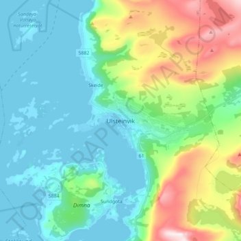
Name: Ulsteinvik topographic map, elevation, terrain.
Location: Ulsteinvik, Ulstein, Møre og Romsdal, 6065, Norway (62.30267 5.80685 62.38267 5.88685)
Average elevation: 492 ft
Minimum elevation: -3 ft
Maximum elevation: 1,988 ft
Thank you for supporting this site ❤️
Make a donation
Make a donation
Gear up for your next adventure:
As an Amazon Associate, this site earns from qualifying purchases at no extra cost to you.